Trips · Estados Unidos
What to see in Chicago
Arquitectura a orillas del río, arte y kilómetros de paseo frente al lago.
- 44places
- 1routes
- 7categories
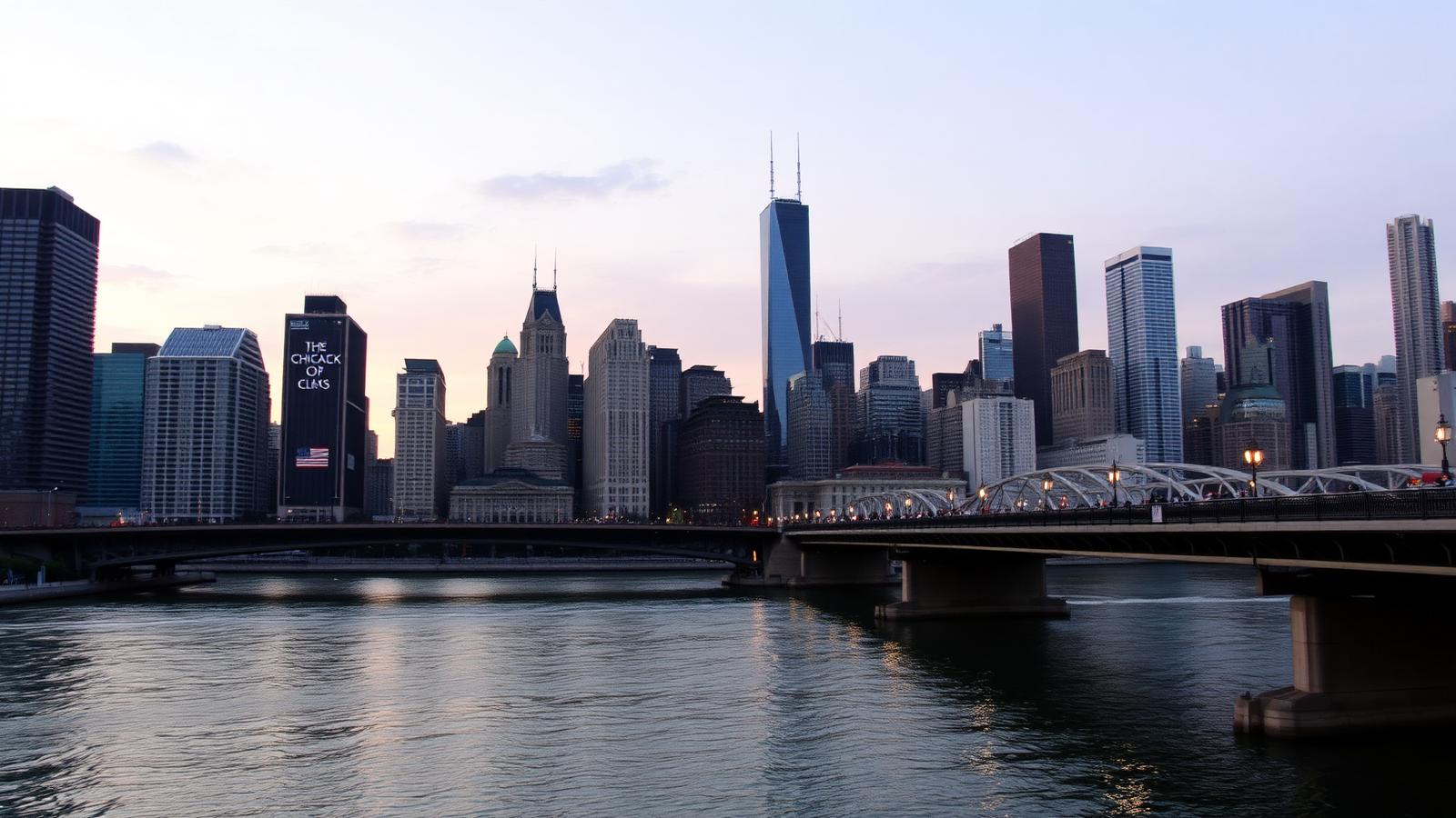
Photo — Daniel Schwen · CC BY-SA 4.0 · Wikimedia Commons
Before you go
- Days
- 3
- Best season
- Mayo a octubre
- Getting around
- Metro elevado, autobús y a pie
- What to eat
- Deep-dish pizza y hot dog de Chicago
- From the airport
- Tren Blue Line desde O’Hare o Orange Line desde Midway.
- Currency and language
- Dólar estadounidense · Inglés
El viento y la temperatura cambian rápido junto al lago.
Everything on the map
Every pin is a place from the guide. Open it for details.
Three steps and it's done
2 days
- 1
- 2
Or build it yourself
Pick the places you want (44 in this guide) and we split the route day by day by proximity.
Pick the places - 3
Turn it into a plan
How you get there and back, where you sleep, your tickets and who's coming.
Create the plan
Usual routes
Choose one to see its map, stops and daily times below.
Chicago esencial en 3 días
Arquitectura, lago y barrios.
Pick the places you want
44 places in this guide. Tick the ones you fancy and we build the route by proximity.
Parque de 10 ha con una gran pantalla, una famosa escultura reflectante con forma de alubia y teatro exterior. Valorado con 4,8 sobre 5 por 93.029 visitantes, se suele estar cerca de 45 minutos, está a 10 min andando del centro. Se suele estar cerca de 45 minutos, está a 10 min andando del centro.
How to get there — A 0,8 km del centro de Chicago, unos 10 min andando.
Antiguo centro de instrucción naval con atracciones de feria, restaurantes, tiendas y fuegos artificiales. Valorado con 4,6 sobre 5 por 88.329 visitantes, se suele estar cerca de 45 minutos, está a 34 min andando del centro. Se suele estar cerca de 45 minutos, está a 34 min andando del centro.
How to get there — A 2,6 km del centro de Chicago, unos 34 min andando.
Gran escultura al aire libre en forma de alubia, con lados espejados reflejan la ciudad desde varios ángulos. Valorado con 4,7 sobre 5 por 40.949 visitantes, se suele estar cerca de 45 minutos, está a 10 min andando del centro. Se suele estar cerca de 45 minutos, está a 10 min andando del centro.
How to get there — A 0,7 km del centro de Chicago, unos 10 min andando.
Pequeño zoológico gratuito con leones, primates, reptiles, sector infantil y una granja interactiva. Valorado con 4,6 sobre 5 por 39.100 visitantes, se suele estar cerca de 45 minutos. Se suele estar cerca de 45 minutos.
How to get there — A 4,9 km del centro de Chicago: mejor en transporte público, taxi o coche.
Famoso museo de arte, con casi 300.000 obras internacionales que abarcan muchos siglos. Valorado con 4,8 sobre 5 por 38.531 visitantes, se suele estar cerca de 90 minutos, está a 9 min andando del centro. Se suele estar cerca de 90 minutos, está a 9 min andando del centro.
How to get there — A 0,6 km del centro de Chicago, unos 9 min andando.
Parque urbano del centro de Chicago, conocido por la escultura Cloud Gate, apodada The Bean, que refleja el skyline de la ciudad y es de las fotos más repetidas del país. Se suele estar cerca de 45 minutos, está a 10 min andando del centro.
How to get there — A 0,8 km del centro de Chicago, unos 10 min andando.
Piso 103 de la torre Willis con cubículos de vidrio que tienen vista panorámica hacia cuatro estados. Valorado con 4,6 sobre 5 por 37.277 visitantes, se suele estar cerca de 25 minutos, está a 7 min andando del centro. Se suele estar cerca de 25 minutos, está a 7 min andando del centro.
How to get there — A 0,5 km del centro de Chicago, unos 7 min andando.
Moderno acuario cubierto, famoso por la variedad de hábitats y las vistas del lago Michigan. Valorado con 4,5 sobre 5 por 33.275 visitantes, se suele estar cerca de 45 minutos, está a 23 min andando del centro. Se suele estar cerca de 45 minutos, está a 23 min andando del centro.
How to get there — A 1,7 km del centro de Chicago, unos 23 min andando.
Museo moderno de invención y ciencia con el tiranosaurio más grande del mundo. Valorado con 4,7 sobre 5 por 31.514 visitantes, se suele estar cerca de 90 minutos, está a 23 min andando del centro. Se suele estar cerca de 90 minutos, está a 23 min andando del centro.
How to get there — A 1,7 km del centro de Chicago, unos 23 min andando.
Emblemático rascacielos de 110 plantas con vistas panorámicas de Chicago desde el mirador de la planta 103. Valorado con 4,5 sobre 5 por 24.090 visitantes, se suele estar cerca de 45 minutos, está a 7 min andando del centro. Se suele estar cerca de 45 minutos, está a 7 min andando del centro.
How to get there — A 0,5 km del centro de Chicago, unos 7 min andando.
Observatorio en el piso 94 del edificio John Hancock con un mirador vidriado inclinado a 305 m de altura. Valorado con 4,5 sobre 5 por 21.056 visitantes, se suele estar cerca de 25 minutos, está a 32 min andando del centro. Se suele estar cerca de 25 minutos, está a 32 min andando del centro.
How to get there — A 2,4 km del centro de Chicago, unos 32 min andando.
Mirador en un rascacielos con vistas panorámicas a la ciudad a 300 m de altura, además de comida y bebida. Valorado con 4,7 sobre 5 por 20.298 visitantes, se suele estar cerca de 45 minutos, está a 32 min andando del centro. Se suele estar cerca de 45 minutos, está a 32 min andando del centro.
How to get there — A 2,4 km del centro de Chicago, unos 32 min andando.
Uno de los grandes museos de arte de Estados Unidos, con obras impresionistas, la colección de pintura americana y los famosos leones de piedra en la entrada. Se suele estar cerca de 90 minutos, está a 7 min andando del centro.
How to get there — A 0,5 km del centro de Chicago, unos 7 min andando.
Fuente rococó de 3 niveles del parque Grant, una de las más grandes del mundo, con espectáculos de luz y agua. Valorado con 4,7 sobre 5 por 17.101 visitantes, se suele estar cerca de 45 minutos, está a 12 min andando del centro. Se suele estar cerca de 45 minutos, está a 12 min andando del centro.
How to get there — A 0,9 km del centro de Chicago, unos 12 min andando.
Auditorio francés de estilo barroco para 3,600 personas, con espectáculos musicales y de comedia desde 1921. Valorado con 4,7 sobre 5 por 10.786 visitantes, se suele estar cerca de 45 minutos, está a 11 min andando del centro. Se suele estar cerca de 45 minutos, está a 11 min andando del centro.
How to get there — A 0,8 km del centro de Chicago, unos 11 min andando.
Museo con pinturas, esculturas, fotografías, videos y actuaciones posteriores a la Segunda Guerra Mundial. Valorado con 4,4 sobre 5 por 6679 visitantes, se suele estar cerca de 45 minutos, está a 30 min andando del centro.
How to get there — A 2,2 km del centro de Chicago, unos 30 min andando.
Sendero junto al río con vista a la ciudad y gastronomía, puentes, muelles para pesca y atracaderos. Valorado con 4,8 sobre 5 por 22.902 visitantes, se suele estar cerca de 60 minutos, está a 14 min andando del centro.
How to get there — A 1 km del centro de Chicago, unos 14 min andando.
German market open during the holiday season with vendors selling treats & unique seasonal items. Valorado con 4,2 sobre 5 por 6108 visitantes, se suele estar cerca de 45 minutos, está a 8 min andando del centro.
How to get there — A 0,6 km del centro de Chicago, unos 8 min andando.
Monumento en Chicago. Valorado con 4,1 sobre 5 por 5908 visitantes, se suele estar cerca de 45 minutos, está a 20 min andando del centro. Valorado con 4,1 sobre 5 por 5910 visitantes, se suele estar cerca de 45 minutos, está a 20 min andando del centro.
How to get there — A 1,5 km del centro de Chicago, unos 20 min andando.
Trattoria moderna y animada en un mercado italiano que ofrece pizza napolitana y pasta casera al dente. Valorado con 4,3 sobre 5 por 5735 visitantes, se suele estar cerca de 45 minutos, está a 21 min andando del centro.
How to get there — A 1,6 km del centro de Chicago, unos 21 min andando.
Teatro elegante de 2,300 plazas con balcón, que pone en escena producciones de Broadway como “Los Productores”. Valorado con 4,7 sobre 5 por 3936 visitantes, se suele estar cerca de 45 minutos, está a 10 min andando del centro.
How to get there — A 0,7 km del centro de Chicago, unos 10 min andando.
Imponente teatro, considerado una joya arquitectónica de 1889, donde se presentan espectáculos de danza, ballet y rock. Valorado con 4,7 sobre 5 por 3201 visitantes, se suele estar cerca de 45 minutos, está a 6 min andando del centro.
How to get there — A 0,5 km del centro de Chicago, unos 6 min andando.
Exhibiciones interactivas, vista al lago y espectáculos de alta tecnología para admirar las estrellas. Valorado con 4,2 sobre 5 por 3078 visitantes, se suele estar cerca de 45 minutos, está a 31 min andando del centro.
How to get there — A 2,3 km del centro de Chicago, unos 31 min andando.
Cadena de supermercados con artículos propios, productos agrícolas, lácteos y más; suelen vender vino y cerveza. Valorado con 4,6 sobre 5 por 2924 visitantes, se suele estar cerca de 45 minutos, está a 23 min andando del centro.
How to get there — A 1,7 km del centro de Chicago, unos 23 min andando.
Compañía de ópera de renombre que ofrece actuaciones sofisticadas en una amplia ópera de estilo art déco. Valorado con 4,8 sobre 5 por 2835 visitantes, se suele estar cerca de 45 minutos, está a 10 min andando del centro.
How to get there — A 0,8 km del centro de Chicago, unos 10 min andando.
Laid-back eatery serving creative sweet and savory pastries, plus Filipino offerings, coffee, and wine. Valorado con 4,5 sobre 5 por 2234 visitantes, se suele estar cerca de 45 minutos.
How to get there — A 4,5 km del centro de Chicago: mejor en transporte público, taxi o coche.
Exoficina postal art déco de 1921 que funciona como complejo de oficinas y centro de eventos. Valorado con 4,7 sobre 5 por 899 visitantes, se suele estar cerca de 45 minutos, está a 10 min andando del centro.
How to get there — A 0,7 km del centro de Chicago, unos 10 min andando.
Gran parque junto al lago Michigan al norte del centro, con zoológico gratuito, jardines botánicos y kilómetros de sendero para pasear o correr junto al agua. Se suele estar cerca de 45 minutos.
How to get there — A 5,1 km del centro de Chicago: mejor en transporte público, taxi o coche.
Barrio del noroeste de Chicago con tiendas independientes, murales, salas de música y una escena de cafés y restaurantes más informal que la del centro. Se suele estar cerca de 60 minutos.
How to get there — A 5,3 km del centro de Chicago: mejor en transporte público, taxi o coche.
Cadena informal, conocida por su pizza estilo Chicago, que ofrece gastronomía tradicional italiana, cervezas y vinos. Valorado con 4,5 sobre 5 por 26.336 visitantes, se suele estar cerca de 45 minutos, está a 12 min andando del centro. Se suele estar cerca de 45 minutos, está a 12 min andando del centro.
How to get there — A 0,9 km del centro de Chicago, unos 12 min andando.
Cadena de restaurantes retro de Chicago; sirven perritos calientes, sándwiches italianos de filete, cervezas y vinos. Valorado con 4,4 sobre 5 por 24.726 visitantes, se suele estar cerca de 45 minutos, está a 23 min andando del centro. Se suele estar cerca de 45 minutos, está a 23 min andando del centro.
How to get there — A 1,7 km del centro de Chicago, unos 23 min andando.
Chic Italian eatery with a riverfront terrace and patio offering craft pizza, pasta, grilled seafood, and wines. Valorado con 4,9 sobre 5 por 18.361 visitantes, se suele estar cerca de 75 minutos, está a 14 min andando del centro. Se suele estar cerca de 75 minutos, está a 14 min andando del centro.
How to get there — A 1,1 km del centro de Chicago, unos 14 min andando.
Institución local conocida por su pizza estilo Chicago con masa caramelizada en un ambiente tranquilo. Valorado con 4,4 sobre 5 por 16.664 visitantes, se suele estar cerca de 75 minutos. Se suele estar cerca de 75 minutos.
How to get there — A 5,6 km del centro de Chicago: mejor en transporte público, taxi o coche.
Diner with an open kitchen using ingredients ranging from bologna to foie gras. Valorado con 4,7 sobre 5 por 12.905 visitantes, se suele estar cerca de 45 minutos, está a 22 min andando del centro. Se suele estar cerca de 45 minutos, está a 22 min andando del centro.
How to get there — A 1,6 km del centro de Chicago, unos 22 min andando.
Cafe and coffee bar featuring the hazelnut-chocolate spread in French and Italian dishes both sweet and savory. Valorado con 4,1 sobre 5 por 10.476 visitantes, se suele estar cerca de 30 minutos, está a 13 min andando del centro.
How to get there — A 0,9 km del centro de Chicago, unos 13 min andando.
Bar típico estadounidense con una refinada y atractiva arquitectura que sirve platos según mercado y cócteles. Valorado con 4,7 sobre 5 por 9997 visitantes, se suele estar cerca de 45 minutos, está a 9 min andando del centro.
How to get there — A 0,7 km del centro de Chicago, unos 9 min andando.
Cafetería donde sirven desayunos y almuerzos, ideal para amantes de los panqueques y otros abundantes platos estadounidenses. Valorado con 4,5 sobre 5 por 9946 visitantes, se suele estar cerca de 75 minutos, está a 12 min andando del centro.
How to get there — A 0,9 km del centro de Chicago, unos 12 min andando.
Cadena local familiar con clásicos italianos y pizzas estilo Chicago con corteza de mantequilla. Valorado con 4,2 sobre 5 por 6556 visitantes, se suele estar cerca de 75 minutos, está a 18 min andando del centro.
How to get there — A 1,4 km del centro de Chicago, unos 18 min andando.
Welcoming coffeehouse with handcrafted coffee, espresso & tea, plus breakfast, lunch & pastries. Valorado con 4,4 sobre 5 por 19.678 visitantes, se suele estar cerca de 75 minutos, está a 24 min andando del centro.
How to get there — A 1,8 km del centro de Chicago, unos 24 min andando.
Restobar moderno y elegante en la azotea del Chicago Athletic Association Hotel con platos selectos de temporada. Valorado con 4,4 sobre 5 por 5649 visitantes, se suele estar cerca de 75 minutos, está a 8 min andando del centro.
How to get there — A 0,6 km del centro de Chicago, unos 8 min andando.
Restaurante concurrido de dos pisos al que acuden grupos para disfrutar aperitivos, platos abundantes, cocteles y jarras de vino. Valorado con 4,7 sobre 5 por 17.219 visitantes, se suele estar cerca de 75 minutos, está a 23 min andando del centro. Buen sitio para probar hamburguesa de barrio.
How to get there — A 1,7 km del centro de Chicago, unos 23 min andando.
Cadena de restaurantes de comida rápida de larga trayectoria, famosa por sus hamburguesas y patatas fritas. Valorado con 4,1 sobre 5 por 3486 visitantes, se suele estar cerca de 75 minutos, está a 28 min andando del centro.
How to get there — A 2,1 km del centro de Chicago, unos 28 min andando.
Cadena ecológica con comestibles naturales y orgánicos, artículos para el hogar y productos como vinos. Valorado con 4,4 sobre 5 por 1985 visitantes, se suele estar cerca de 75 minutos.
How to get there — A 3,9 km del centro de Chicago: mejor en transporte público, taxi o coche.
Getting around the city
Metro, bus and commuter trains — which ticket to buy and what it costs.
- The L (CTA)Ocho líneas elevadas; la Blue Line llega desde O'Hare.Official siteVentra
Your route by day
Pick places above and we show the order, each day's route and how long it takes.
Know another place?
Tell us and, if it fits, we publish it in the guide with your name.
Sign in to suggest a place